This is the last of my three part series covering several natural areas I recently visited in the Bay Area; South Bay as it were, southern San Francisco Bay.
Part I — Don Edwards San Francisco Bay National Wildlife Refuge-Alviso Unit
Part II — Ed R. Levin County Park
In Part III we come back to the Alviso area (Part I) at the southern margin of San Francisco Bay. We’re at Alviso Marina County Park, where the Guadalupe River enters San Francisco Bay and becomes Alviso Slough, a meandering tidewater channel.
|
THE DAILY BUCKET IS A NATURE REFUGE. WE AMICABLY DISCUSS
ANIMALS, WEATHER, CLIMATE, SOIL, PLANTS, WATERS AND NOTE LIFE’S PATTERNS.
WE INVITE YOU TO NOTE WHAT YOU ARE SEEING AROUND YOU
IN YOUR OWN PART OF THE WORLD,
AND TO SHARE YOUR OBSERVATIONS IN THE COMMENTS BELOW.
FOR MORE INFORMATION ABOUT THE PURPOSE AND HISTORY OF THE DAILY BUCKET FEATURE,
CHECK OUT THIS DIARY:
DAILY BUCKET PHENOLOGY: 11 YEARS OF RECORDING EARTH'S VITAL SIGNS
IN OUR NEIGHBORHOODS
|
 Red Dot marks the location of Alviso Marina County Park
Alviso Marina County Park is situated where the Guadalupe River transitions to Alviso Slough, about where the tidal influences become stronger along this watercourse. The Guadalupe River drains a substantial area of Santa Clara County, flowing through highly urbanized areas, including downtown San Jose.
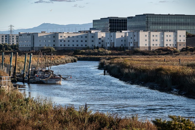 Looking south, upstream, on the Guadalupe River from Alviso Marina County Park
The Guadalupe River is the southernmost major U.S. river with a Chinook salmon run. It’s been proven through DNA analysis that the salmon were historically native to the Guadalupe River watershed.
Great Egrets, Great Blue Herons, and Willets were working the banks of the river and the slough.
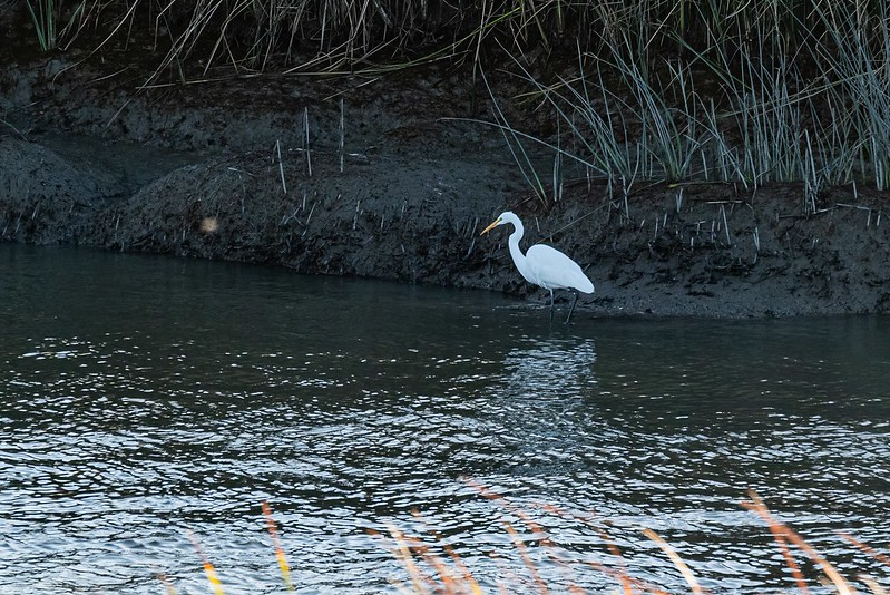 Great Egret
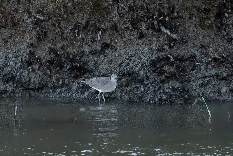 Willet (photo significantly cropped and processed)
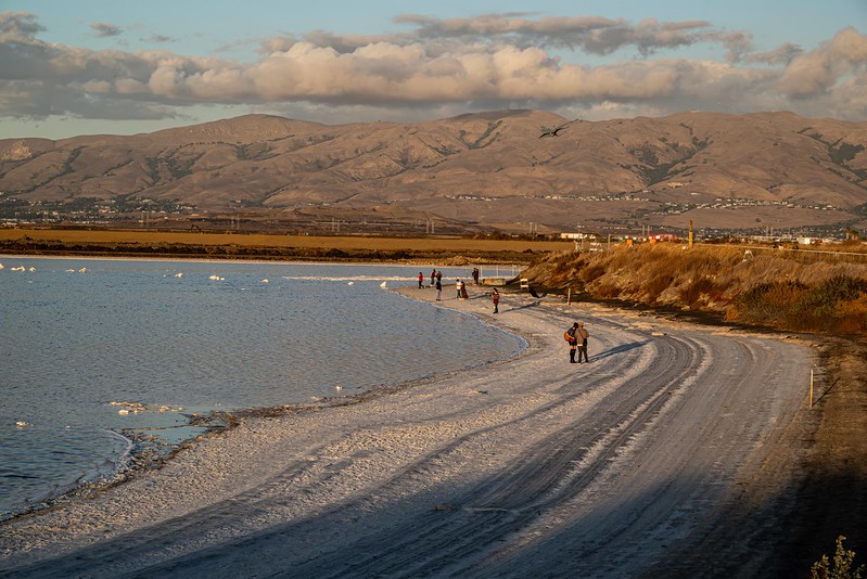
The south end of San Francisco Bay has been used for salt production since the Gold Rush days. The salt evaporation ponds were once extensive but have mostly been restored back to salt marsh habitat. Cargill still maintains some salt evaporation ponds and salt production.
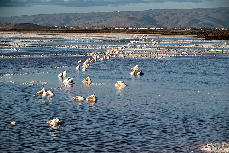 Former salt evaporation pond
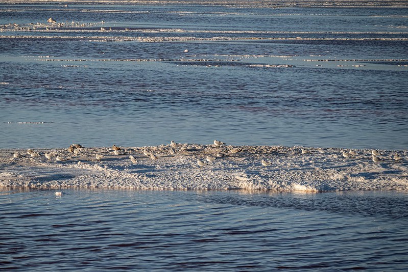 Gulls were taking advantage of a few salt-encrusted island. The gulls included California Gulls, Ring-billed Gulls, Herring Gulls, and Western Gulls.
It was late afternoon/early evening and gulls were streaming in overhead from the south, dropping in on these salt islands. I snapped quite a few gif’s as they passed overhead.
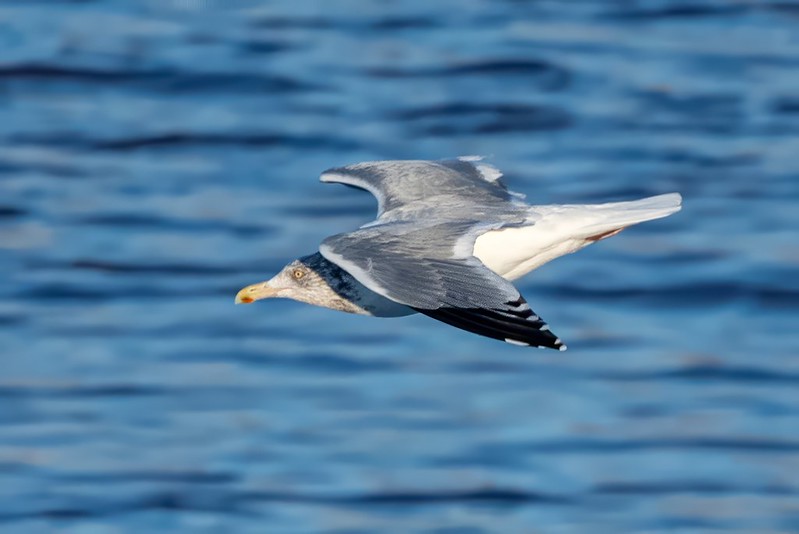
 California Gull
 California Gull
 California Gull
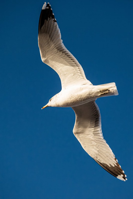
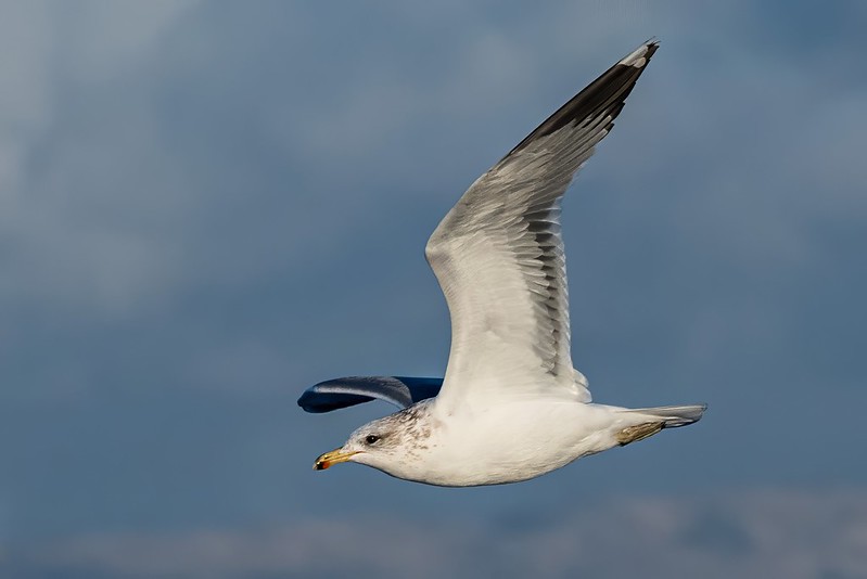
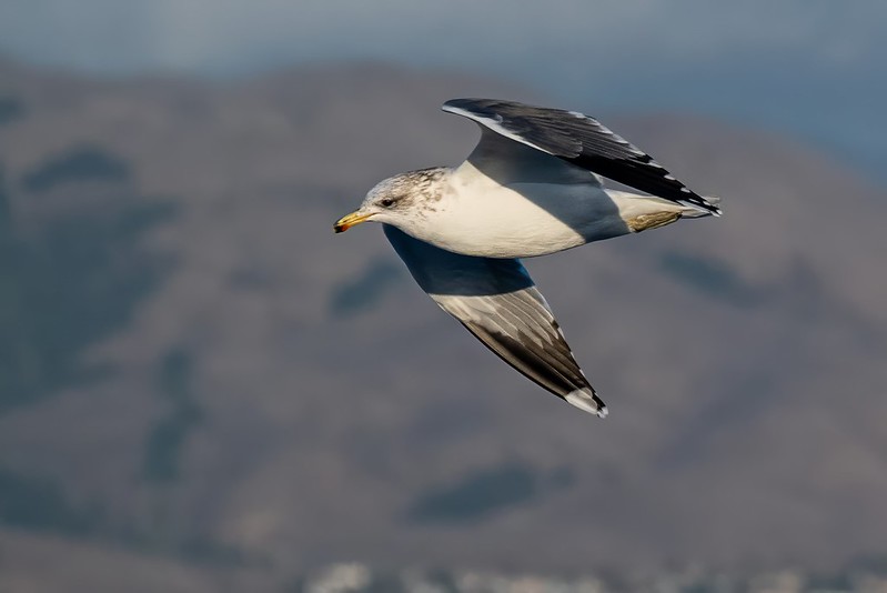
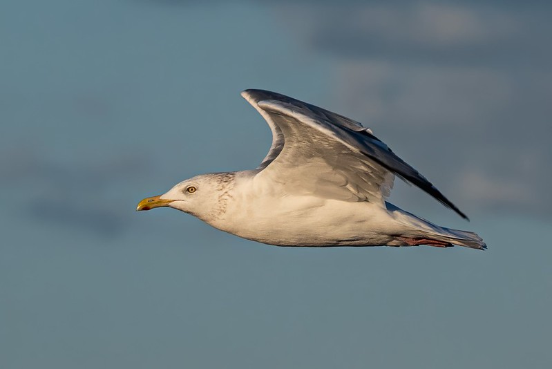 Herring Gull
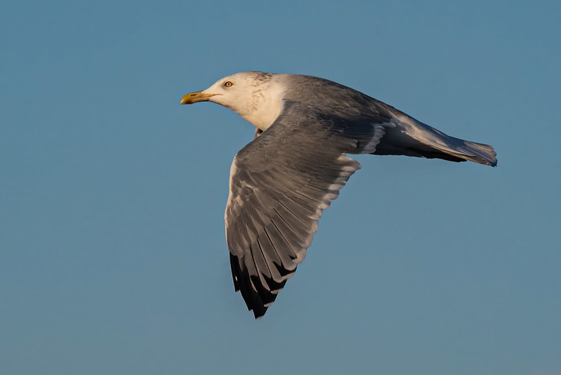 Herring Gull
 Herring Gull
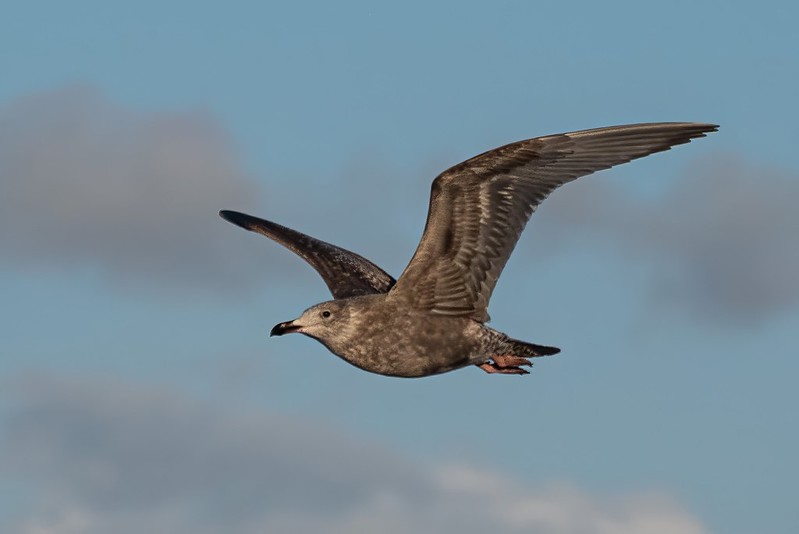 Western Gull (juvenile, first year)
Please comment on any gull misidentifications or uncertainties.
I wandered a ways out on the Alviso Slough Trail that follows a dike separating a former salt pond from the slough. It also marks the boundary with Don Edwards San Francisco Bay NWR that includes the former salt pond shore and the former salt pond. This area is marked closed by numerous signs on top of the dike. Yet people ignored the signs and were walking freely along the shoreline that is part of the NWR. What is wrong with people?
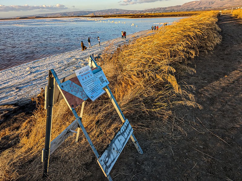 Area closed
 Area closed
This was the last of the three-part series of my Bay Area trip. Thanks for joining me. What’s going on in everyone’s worlds?
Thanks for reading the Daily Bucket.
Phenology is how we take earth’s pulse.
We discuss what we see in each Bucket.
We value all observations, as we ponder life’s cycles.
Now it’s your turn.
Please comment about your own natural area, and include photos if possible. We love photos!
To have the Daily Bucket in your Activity Stream, visit Backyard Science’s profile page and click on Follow, and join to write a Bucket of your own observations.


